Footpaths
Washfield has nine footpaths to explore. Explore these online using the Devon County Council interactive map.
The information below has been produced to help us explore our local rights of way.
The point of contact on the Parish Council is Will Wood, please contact him on 07809 559390 to report any issues with the footpaths.
You can check if an issue has already been reported using the Devon County Council interactive tool.
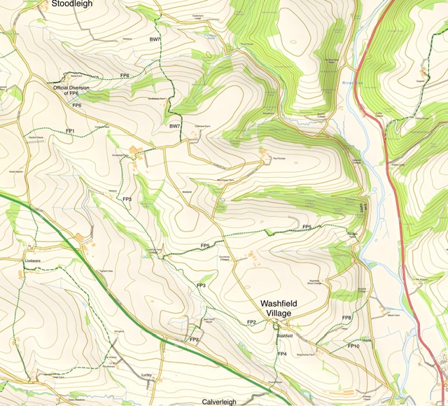
Footpath one. Charterhouse (was Cuckoo's Nest) to Long Lane, near Haydon. 0.54 miles.
Footpath two. Mousebeare to Long Lane via New Park and Lower Pitt. 0.7 miles.
Footpath three. From Footpath two in field above New Park to Ennerleigh via Courtenay. 1.44 miles.
Footpath four. Brook Lane to Long Lane then over the Link Road towards Calverleigh. 0.73 miles.
Footpath five. Bullfinches, Lower Washfield, to Courtenay via Stanterton. 1.31 miles.
Footpath six. Road between Charterhouse and Slade to Bridleway 7 below Smiths. 0.75 miles.
Bridleway seven. From lane above Smiths Farm to lane above Ramstorland. 0.92 miles.
Footpath eight. Nibbs lane to Lower Washfield. 0.44 miles.
Footpath ten. Beeches to Lower Washfield lane above Stagstile. 0.32 miles